

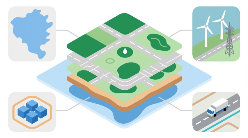
Location, location, location – place is as significant when buying a house as it is when running a business, growing crops, or planning a military campaign. And no matter what activity you’re embarking on, it’s a uniquely good time to be manipulating geospatial data. Geospatial data sets are information rich and the overall available data has been growing by 20% per year over the estimate 1 petabyte recorded in 2009, and there are countless ways to leverage that information for financial gain.
Geospatial Data In Daily Life
Though it may seem like a highly technical concept, most people use some type of geospatial data system every day because such programs are used to route Uber drivers, assess credit risk and lending rates based on zip code, and determine insurance rates by identifying homes at risk of flooding, earthquakes, and other natural disasters. Even kids use geospatial data to play games like Pokemon Go.
Geospatial information is everywhere and, in a world where everyone is attached to a smartphone, we’re constantly connected to it. Put simply, geospatial data just means that the information set is tied to zip codes, addresses, or coordinates, among other possibilities. It’s a map or an address book, reinterpreted for a digital ecosystem.
The Open Data Revolution
Though there are plenty of groups building geospatial data sets, one of the factors that has most contributed to this new digital world is the availability of open data sets. Open data is available for use by any interested party, specifically for the purposes of innovation, and the data may be supplied by governments, professional groups, or non-profits. But is it really beneficial to let others use what could be proprietary data? Singapore serves as a useful case study.
More Read
In Singapore, the government supports a data-sharing platform known as the common spatial data infrastructure (CSDI) for business use. Information is supplied in application programming interface (API) format so that it can easily be integrated into digital solutions, and the state reaps the benefits when resulting solutions are integrating into “smart city” solutions. At present, Singapore is one of the most advanced, networked locations anywhere in the world.
Increasing Business Value
Of course, governments don’t have the same profit motivation to protect their data that businesses have, but geospatial data doesn’t have to be open for it to be beneficial. In fact, a lot of narrow business data isn’t especially useful for anyone besides its owners. For example, many companies use geospatial data to assess the value of possible business locations; using many different categories, the company can determine delivery costs and efficiency, potential local buyers, utility prices, crime, and other important metrics. Though they may draw on open data sets for some of this information, other elements can only be derived from in-house data. The results are of limited value – it’s the underlying data that matters.
Protected But Valuable
If some geospatial data sets are free-for-alls with broad applications and some are only useful to the businesses that generated them, there’s a third type of data that falls somewhere in between. Geospatial data used by the military often resides under lock and key for national security reasons, but it’s also liable to be licensed to private contractors who are developing products for the armed forces.
Alternatively, there are also private military contractors who develop products to enhance military data sets. Such programs include commercial image exploitation software that can analyze geographic attributes, identify activity patterns in different regions, and even work with satellite images and live video, as well as geospatial data production services, and image library services that organize and provide access to this information. The end result of all of these programs is that the military is able to act with greater accuracy on the ground, protect their assets, and secure supply lines, among other key actions.
A Sense Of Place
Finally, though much more mundane than military applications, one of the industries that has been impacted the most by the rise of geospatial data is the real estate industry. An industry that was fundamentally unchanged for decades, real estate has undergone dramatic changes in recent years, including using geospatial data to assess property value and determine trends, such as what neighborhoods are likely to become popular. This data also pairs powerfully with other data management programs, such as those designed for running multi-unit buildings and software that assesses the environmental impact of different spaces. Geospatial data helps keep us safe, forms the substructure for games, tells businesses where to put their shops, and fundamentally, no matter its application, it drives profits. The military buys the right weapons or routes supplies so that they aren’t captured, real estate agents focus on more profitable homes, and businesses find the perfect location. Because as complicated as some of the processes behind geospatial data may seem, it all comes down to a simple principle: the more we know about a task or activity, the more efficiently it can be performed.