
Here at Smart Data Collective, we never cease to be amazed about the advances in data analytics. We have been publishing content on data analytics since 2008, but surprising new discoveries in big data are still made every year.
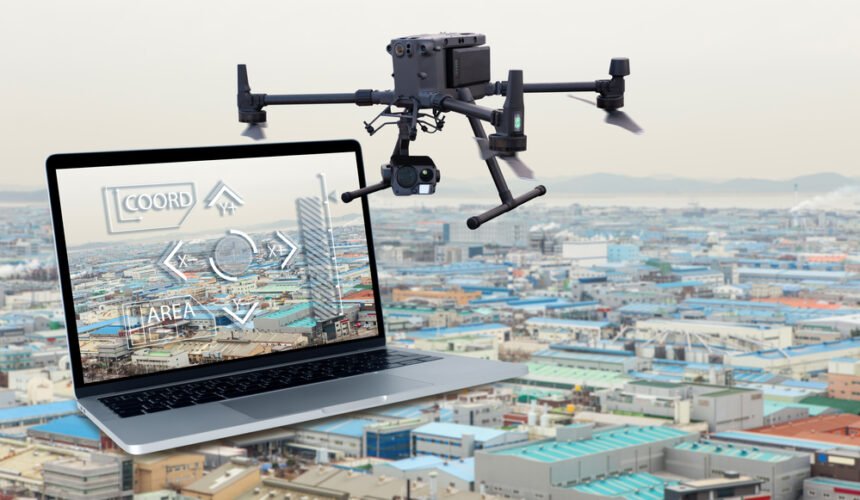
One of the biggest trends shaping the future of data analytics is drone surveying. As more surveying companies harness the power of drones, they are compiling more data that can be used for energy procurement construction, oil drilling, defense applications and many other purposes.
However, despite the benefits they offer, Colin Snow points out that drones create some challenges with data analytics. You must have quality control systems in place to get reliable data with drones.
Drones Surveyors Are Pioneers in the Data Analytics Field
It may seem like all one has to do to use a drone for surveying is learn how to use the drone properly. While this is definitely true, there are a few best practices that users need to learn to use it properly.
Drone surveyors must also know how to gather and use data properly. They will need to be aware of the potential that data can bring to entities using drones. Indiana Lee discussed these benefits in an article for Drone Blog.
“Demand for big data for commercial uses, technological advancements, and increased venture capital funding will continue to drive rapid growth in drone use. Agriculture, real estate, construction, and highway safety are some of the industries analyzing this data. While drones are valued for the images and video footage they collect, they are increasingly able to store other types of information, including radio signals, soil moisture, factory emissions, and geodetic data, which includes precision measurements for land surveys.”
The following are some practices in drone surveying that could make a difference. You will also want to know how to harvest the data that you get.
Do an Overcast Survey to Ensure You Get Reliable Data
We have talked extensively about the importance of both data quality and data quantity. You have to ensure that you have quality assurance protocols baked into your data collection methodologies. Otherwise. your data might be tainted and lead to poor data-driven deductions down the road.
When you are collecting data with drone surveillance, you will want to make sure that you conduct your surveying during the rights time of day. This requires you to make sure that light levels are optimal.
When you’re surveying, you might think the best time to do so is when the sun is out. Sunlight is used to take some spectacular photographs, so it should work for surveying, right? Well, that’s incorrect. Too much sunlight could cause some issues. and lead to poor quality through your surveying efforts
The model quality may suffer because too much sunlight may add a lot of reflections to the images the drone is capturing, which in turn reduces data quality. That’s not a good thing for anyone. Drone users will have to schedule surveying on overcast days. It doesn’t have to be heavy overcast, just a day that isn’t too sunny for best results.
Use Compatible Drones for Higher Quality Data
Sometimes, people think that all drones are pretty much the same, but there not. Some drones are specialized, and this is something you need to be aware of. Choosing a compatible drone should help ensure your drone surveying goes well and data quality is maximized. For example, if you need a drone to help improve security within a warehouse or something similar, you’ll need indoor drones for security.
An indoor safety drone has all sorts of features that make it ideal for indoor use, like safety guards and motion detectors. When one is shopping for a drone, the objective has to be clear. Once that objective is clear, it’ll be a lot easier to find the right drone. Take your time. Finding the right drone isn’t simple, but it’s worth it. Talk to a drone specialist and describe the functions you need.
The Camera Settings
Camera settings are also going to affect the quality of data you get through drone surveillance. Many are tempted to change their camera settings, thinking they might get better results, but that isn’t always the case. If you want to stay with the basics, stay safe, you’ll want to make sure the format is set to jpeg. In addition to that, you’ll need to keep the aspect ratio at 4:3. Doing this should help you capture images well without any distortions.
You might also want to turn the vivid color mode on to ensure the images look alive. If you don’t like the vivid color mode because the colors look too vibrant, you could also increase the sharpness of the pictures. You’ll want to try to increase the sharpness only a little. Evaluate the results and adjust as needed. You want clarity when surveying to get the highest quality data, so be sure to pay close attention to that.
The Flight Speed
Speed is a big deal when surveying, yet it’s something folks don’t always pay much attention to. Generally speaking, you want your drone to fly between two to five miles per hour. Those who need the survey for context can speed things up a bit but stick to four or five miles per hour.
Your pictures don’t have to be that detailed if that’s all you want to accomplish, but if you want details, then you’ll need to slow down a bit. You want to keep your drone flying at two or three miles per hour, nothing more. The drone is going to take a picture every two to four seconds. That’s a lot of images. Evaluate the pictures taken and adjust the speed if necessary. Sometimes, depending on the size of the drone and the quality, you might need to change speeds.
The Vegetation Issue
Yes, there’s a vegetation issue that needs to be addressed. The fact is that surveying land with twigs, thin fences, or dormant trees could be a problem. For some reason, drones have a hard time capturing these sorts of images and being aware of this should help you find ways around this small issue.
The first thing you want to do is make sure you slow down when surveying. You already know how to do that. A slow survey is one thing you need to do, but there are others, like making sure you take a few pictures manually for greater overlap.
It may also be a good idea to take a few pictures at an angle. This is a helpful trick because that thin vegetation can’t hide because drones can easily capture vertical structures. If you want high-quality results, be sure to avoid windy days. These days usually cause errors when taking pictures because those thin twigs and trees move from image to image causing distortions.
These are some of the best practices to keep in mind when drone surveying. It’s going to take some time to get good at surveying, but with patience, you’ll get there.
Implement Data Quality Control with Drone Surveying
Drone surveillance is changing the future of data analytics. However, it is important to have a solid data quality control system in place. The aforementioned tips can do a lot to help.


