
The scope of satellite big data applications has dramatically increased lately. Satellite companies offer commercial high-resolution images, and computer companies provide mighty cloud facilities to process them. Basically, while one company retrieves images, the other one ensures their computing.
Spatial data helps almost in any niche of human activities. Satellite imagery fuels scientific researches and drives many businesses. In particular, big data agriculture enables farmers to inspect their fields remotely, detect and respond to critical issues on time.
EOSDA Crop Monitoring allows assessing the crop state, checking fertilization needs in every field zone, scheduling field treatment, etc.
How It Works
The size of satellite imagery collection is impressive, and NASA’s Landsat mission occupies its honorary place in this regard, flaunting its 46-year imagery archive and offering it to public view.

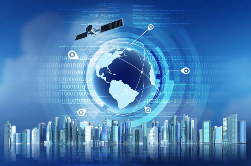
Presently, over 2,600 operational satellites are orbiting Earth, with various revisit times. They are more advanced than their predecessors: they are lighter and better equipped. However, edgy hardware is not their sole advantage. Many of them rely on AI and machine learning, which enables them not only to retrieve images but analyze them.
The number of images acquired is overwhelming and requires pre-processing, processing, and assessing the results.
The imagery transmission in almost real time demands immediate image pre-sorting and calibration. While onboard cameras and computers are smart enough to cope with the task, satellites don’t have enough space for big data storage or strong analytics.
This is where ground stations help. In the past, these stations were but a few, which increased the data transmission intervals. Nowadays, satellites can transmit the retrieved images all the time. Then, more powerful ground computers process and analyze big data, tailoring analytics to specific customer needs.
Yet, the key and most edgy technology advancement nowadays is cloud big data processing and analytics. It shifts the analytic possibilities to a dramatically higher level – more scalable, flexible, and cost-effective. A growing number of applications are making it possible to store big data in space, which creates even more benefits.
Data-Driven Decisions for Government and Business
Geospatial data supports regular citizens’ everyday needs when they are checking the bus ETA at the stop or the availability of medications at the local pharmacies. However, the primary users are government and business. Big data is applicable in agriculture, forestry, marine sciences, security, healthcare, education, communications, transportations, navy and military forces, and many more.
Comparing the images captured on different dates, it is possible to trace the changes and predict the potential development. Current data allows checking what is going on our planet now and making proper decisions.
GIS-based weather forecasts are among the most common applications used by state and private businesses as well as ordinary people.
Satellite images helped monitor environmental and technological disasters like Colorado and California wildfires, Hurricane Laura, or the Calving of the Brunt Ice Shelf, to mention a few. Sadly, the year 2020 was overwhelmingly rich in them.
Agriculture is among those multiple industries that considerably benefit from big data analytics:
- Vegetation indices help assess crop health.
- Variable rate application (VRA) allows agronomists to differentiate field treatment and reduce inputs.
- Scouting apps facilitate assignment scouting tasks.
- The farm activity log neatly organizes field activities.
- Weather reports enable farmers to adjust to weather conditions.
- Field Leaderboard shows all the fields on one screen.
Farmers can track their fields at any time and from any place, provided they have a gadget connected to the internet. Most agricultural apps are easy to understand and offer demo accounts to see how everything works.
Agriculture imagesprovideactionable insights thatsignificantly improve the farm management experience. More and more farmland owners adopt precision farming technology, recognizing its advanced possibilities.
Big data in agriculture involves both hardware and software use. Hardware (e.g., satellites, sensors, drones) retrieves the data about the fields. The software collects it, processes, and performs analytics. In its turn, analytics empowers farmers with credible information for weighted decisions.
Challenges of Adoption and Implementation
Despite all the benefits of big data, not everyone can enjoy it. The matter is its accessibility and affordability. Thus, farmers from developing countries can hardly access big data analytics because:
- It is too expensive for them.
- They don’t have the required facilities.
- Internet connectivity is poor or absent in their region.
- They don’t have enough skills to use precision agriculture software.
The greatest paradox is that big data accelerates development but is not available in the countries that need it most. Agribusinesses that could boost yields and profit cannot access or afford it at the same time. The problem solutions could be supporting government initiatives and credit accessibility.
In fact, the use of big data strongly depends on the data revolution that will accelerate the scope and geography of its implementation and make it more accessible to people. This way, developing countries will break through the vicious circle when big data and artificial intelligence can promote global development, but it can’t work in developing countries due to a lack of access.
Nonetheless, big data suggests big change, and development is speeded up by learning. Hopefully, with joint efforts of governments and the whole global community, the progress will sooner or later come.


